
Looking Up Commerce City Neighbors
A block-level neighbor lookup joins a starting address to the sources that surround it. Adams GIS supplies parcel shapes and map layers. The assessor supplies property and owner clues. Landmark Web supplies recorded parties by grantor or grantee. eTRAKiT supplies permits, inspections, reviews, conditions, and attachments on selected properties. Voter data can answer an individual registration question, but it cannot be used as a simple list of every nearby person. Community pages add governance contacts rather than member rosters.
| Block source | What it can show | Access or limit |
|---|---|---|
| Adams GIS | Adjacent parcel shapes, IDs, boundaries, and layers | Public map; informational, not a survey |
| Assessor | Owner, assessment, situs, possible mailing address | Address and owner search advertised; live card gap |
| Recorder | Recorded party and deed history by owner or legal description | Grantor/grantee route; no tract index |
| eTRAKiT | Permits, project roles, inspections, reviews, conditions | Public current search; earliest year not stated |
| Voter data | Public fields in an individual or requested file | Confidentiality and request rules apply |
| Community pages | HOA, metro-district, map, service, and declaration clues | No public member directory located |
The table answers “which source should be next?” It does not convert a parcel owner into a current occupant or a community contact into a list of neighbors.
Map Commerce City Blocks by Parcel
The Adams County GIS instructions describe a click-and-browse method. Search by street number and street name, choose the left-panel match, click the parcel number, zoom, turn on Map Layers, and use Identify or Attributes. To inspect neighbors, close or minimize the attribute panel, pan to the adjoining polygon, click it, and repeat. Save the starting address, map date, parcel or APN, layer name, and the next parcel selected.
- Open the Adams County Basic GIS viewer and search the starting street number and street name.
- Choose the matching result and click the parcel number to open the map identity.
- Zoom and turn on Map Layers, then use Identify or Attributes for the parcel.
- Pan to each adjoining polygon, select it, and record the next APN or account.
- Confirm an important boundary with the assessor, recorded plat, or recorder legal description.
The viewer’s measure, select, buffer, and export controls were not confirmed because the endpoint returned a 403 during research. Do not infer a radius result that the current interface has not shown.
- Parcel
- A mapped or legally described land unit with its own identifying number or account.
- Adjacent parcel
- A neighboring polygon on the map, which still requires a source check before a boundary claim.
- Map layer
- A visual data set such as parcel, address, neighborhood, zoning, or boundary information.
Commerce City Neighbor GIS Boundaries
The county warns that GIS and assessment data can contain omissions or errors and is not an official survey. That warning matters around fences, alleys, subdivision edges, annexation lines, and parcels that sit near an unincorporated pocket. A visual polygon is a discovery tool. A recorded plat or legal description is the stronger source when a line affects a deed, address, or service question.
The city’s Maps, Data and GIS materials identify boundary, annexation, growth, zoning, ward, and neighborhood layers. The neighborhood legend includes Adams City, Derby, Dupont, Irondale, Reunion, and 56th Avenue Industrial Park. Those labels are useful crosswalks, but they are planning or map categories rather than a public roster of people.
The Commerce City Maps, Data and GIS page is the city-level context for a block lookup.
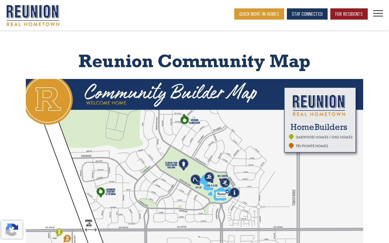
The community map image helps orient a neighborhood label, while parcel identity must still come from county or recorded sources.
Commerce City Neighbor Governance Sources
Neighborhood websites can help identify who manages a district, where services are assigned, and which declaration or map applies to a parcel. They do not automatically publish member names. Reunion publishes HOA and metro-district contacts, policies, covenants, architectural review, parks, trails, and a recorded 2002 declaration. Second Creek Farm Metro District 2 separates district services from city and HOA responsibilities. Turnberry publishes management and board-minute material from 2019-2021.
Reunion’s Model Directory lists HOA or management and civic or library links, not a resident roster. Its Stay Connected source gives Reunion HOA/MSI and Parkside Townhomes & Gallery HOA/MSI at 303-420-4433. A contact is a route to governance information, not proof that a person lives in the surrounding block.
| Reunion | HOA, management, civic, and library contacts; no member list located. |
|---|---|
| Second Creek Farm Metro District 2 | District site for services, covenants, open space, recreation, and architectural roles. |
| Turnberry | Community site for management, payment, and board-minute material. |
The Reunion community directory image shows the kind of governance contact layer that belongs beside a parcel trail.
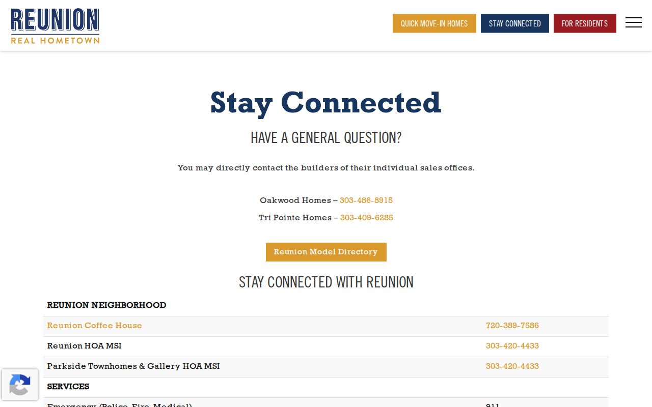
Use a community source to identify a responsible office or district, never to imply that an association page names every neighbor.
Commerce City Reunion Service Context
Reunion’s official pages connect a planned community to HOA, metro-district, recreation, architecture, covenant, and park information. The recorded declaration and community map can help explain why a parcel record, a district page, a service chart, and a city map use different labels. Those documents are valuable context when the goal is to understand the block’s governance or service structure.
The Reunion map is not a resident directory. Use it alongside the parcel APN, recorded subdivision filing, and city boundary layer. If the community claim overlaps a parcel, confirm the subdivision and district source before routing the property to an association. The map can explain a place; it cannot identify every person associated with it.
The Reunion community map is the source for the local layout.
Commerce City Second Creek Farm Maps
Second Creek Farm Metro District 2 describes a covenant-controlled community about one-quarter mile south of 104th Avenue and Tower Road. Its official material describes 923 homes constructed during 2020-2025 and separates USPS, city, district, and HOA responsibilities. The service chart lists USPS at 7351 Magnolia Street, city streets, garbage and mosquito services, and HOA roles for covenants, architecture, open space, and parks.
That distinction helps a Commerce City neighbors search avoid a common category error. A district service chart can identify who handles an issue around a parcel, but it does not reveal a utility customer, a household member, or a current occupant. Save the chart date and the parcel or subdivision used to connect it.
The Second Creek service chart supplies the responsibility split.
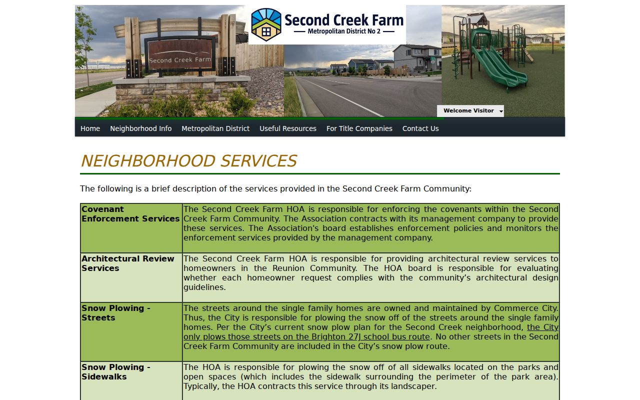
The service chart image is a governance reference, not a person-level record.
The Second Creek Farm community site supplies the district’s broader scope and construction context.
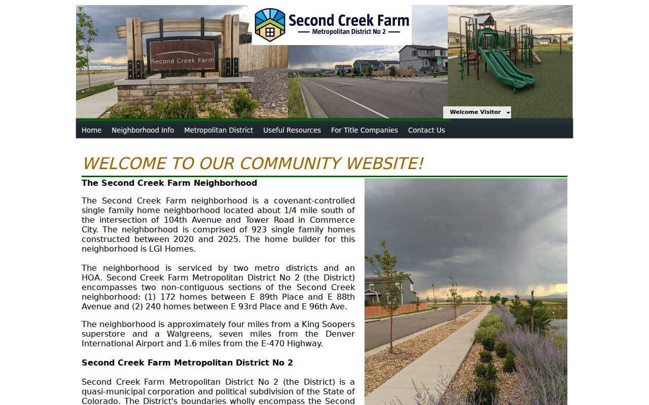
Newer community pages can date a street’s build-out even when a printed directory has not yet caught up.
Permit Chronology Around Commerce City Neighbors
eTRAKiT can add physical-neighborhood context without pretending to identify every neighbor. Its search accepts address, parcel ID, permit type, applicant name, owner name, status, and ZIP. Result tabs can show contacts by role, inspections, conditions, reviews, area information, contractor status, project information, and attachments. Submitted application material becomes a public record subject to CORA, with protected information still subject to law and redaction practice.
Permit SFD231012 demonstrates the join. The closed detached single-family record is tied to 12352 E. 101st Place, APN 172113209004, Turnberry Filing No. 6, Block 3, Lot 17, and related records RMSTR23-00003, CO23-00187, and MSC231012. It shows application, issue, and final dates plus 49 inspections, 11 conditions, and 3 reviews. A permit applicant or contractor role remains a project role, not a household conclusion.
For older code, land-use, inspection, or address-plat records, ask Commerce City or Adams County for a defined address, parcel, case type, and date range. Separate requests are easier to search than a broad demand for everything on a street.
Commerce City Neighbor Blocks, Not Voter Lists
The Colorado individual voter lookup requires First Name, Last Name, ZIP, and full birthday. That makes it a confirmation tool, not a way to enumerate adjacent parcels. A purchased voter file can contain public name, residential address, party affiliation, birth year, and prior-election participation fields, but protected voters and confidential fields are withheld. The county and state request routes have their own fees and file choices.
A voter record can answer whether a name and address appeared in the registration system for a relevant period. It does not establish ownership, household composition, voting choice, current physical presence, or a substitute address. A block-level result should preserve the source date and not reproduce a full birthday or protected field.
When the goal shifts from nearby parcels to a full named street, use the Commerce City street directory workflow instead of stretching the voter lookup beyond its design.
Commerce City Neighbor Property Alerts
Adams Landmark Web offers a free property-fraud activity notification. The form accepts personal or business selection, name confirmation, email confirmation, and send-confirmation or unregister controls. It watches future recording activity for a requested name. It is not a historical deed index, a block alert, or a substitute for tracing a chain of title.
A fraud alert can be useful when a property owner wants notice of a new filing. It does not establish that a person lives at a parcel, and it cannot identify all neighbors. Search the recorder’s official page directly if a mailer or message asks for payment or urgent action.
The Adams property-fraud alert source documents this future-facing service.
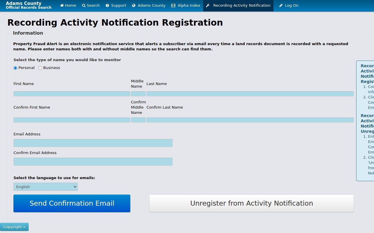
The alert image shows a notification route tied to a name, not a directory of the surrounding block.
Privacy Limits on Commerce City Neighbor Lookup
A parcel map may show an owner while leaving other household members, children, protected voters, utility customers, delivery recipients, and unlisted phone users outside the public record. The Colorado Address Confidentiality Program can provide a legal substitute address and mail forwarding for qualifying survivors. A public map must not be used to reverse that protection into a private location.
Colorado’s Open Records Act, C.R.S. §§24-72-201 et seq., allows a specific request subject to exceptions. Commerce City accepts requests online, by fax, in person, or by mail. Ask separately for permits, code or land-use cases, inspection results, address plats, and attachments. A request cannot override vital, voter, court, juvenile, sealed, or ACP protections.
The official record route should be compared with the commercial people-finder category carefully. Official rolls name a custodian and field definition. A commercial report may combine public filings, address history, marketing data, and purchased datasets, but its match logic, refresh date, and correction path may be unclear.
| Route | Useful for | Boundary |
|---|---|---|
| Official parcel and deed sources | Owner, parcel, recorded party, legal description | Not every occupant or household member |
| GIS and community sources | Adjacent shape, service area, governance contact | Map or governance context, not member roster |
| Commercial people-finder category | Broad compiled clues | Source quality and lawful-use limits vary |
Lawful use. Commerce City neighbors research is for lawful personal, family, civic, and safety purposes. Do not use a parcel, voter, permit, community, or registry record to stalk, harass, threaten, or intimidate another person.
A sound block lookup ends with a map date, parcel key, custodian, source link, and stated limitation. That evidence trail is more reliable than an unsupported claim about who lives nearby.